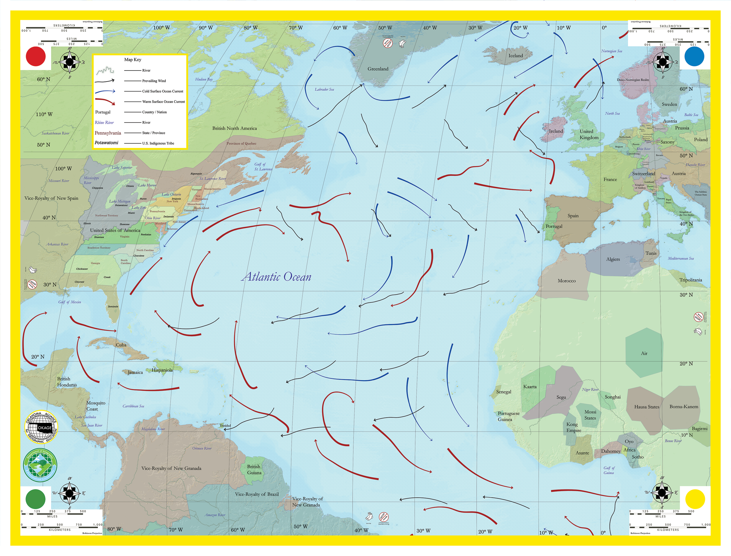
Atlantic Ocean Giant Traveling Map
The Atlantic Ocean Giant map measures 27.5 by 21 feet.
Atlantic Ocean Giant Map Lesson Plans
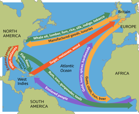
Understanding Triangular Trade Using the Historical Atlantic Ocean Giant Map
This interactive and engaging lesson allows students to explore the cultural and physical geography that led to Triangular Trade. Students learn about what items were traded and where they originated from as well as how ocean currents and trade winds influenced the routes taken by ships. The lesson is adapted from “The Global Economy” by the Colonial Williamsburg Foundation. Click or tap on the image to access the lesson.