
Click on the image above to open the lesson. It will open as a Google Doc.
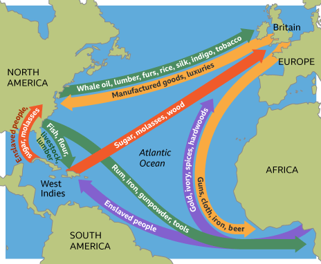
Description: This interactive and engaging lesson allows students to explore the cultural and physical geography that led to Triangular Trade. Students learn about what items were traded and where they originated from as well as how ocean currents and trade winds influenced the routes taken by ships. The lesson is adapted from “The Global Economy” by the Colonial Williamsburg Foundation. Click or tap on the image to access the lesson.
Grade level (s): 5-8 grade, can be adapted for higher or lower grade levels
Standards: OAS
Produced by : Amy Williams