Gridiron Geography - 2011

Click on the image above to download the lesson. This lesson will open in a Google Drive folder instead of a zipped file due to its size.

Click on the image above to download the lesson. This lesson will open in a Google Drive folder instead of a zipped file due to its size.

Description: Using the Big 12 Football schedule as a guide, your students will learn about the geographical and historical significance surrounding the participating teams' campuses, home cities or towns, home states, mascots, players, and more!

Grade level(s): Upper Elementary, Middle School, High School
Standards: GFL
Produced By: Janet Hall, Lyndal Caddell, Glenda Sullivan, Brad Bays, Patricia Anduss, Ann Kennedy, Bill Amburn, Denise Rhodes, and Eugene Earsom.

Trade Game: Analyzing Global Oil Trade

Click on the image above to download the lesson

Click on the image above to download the lesson

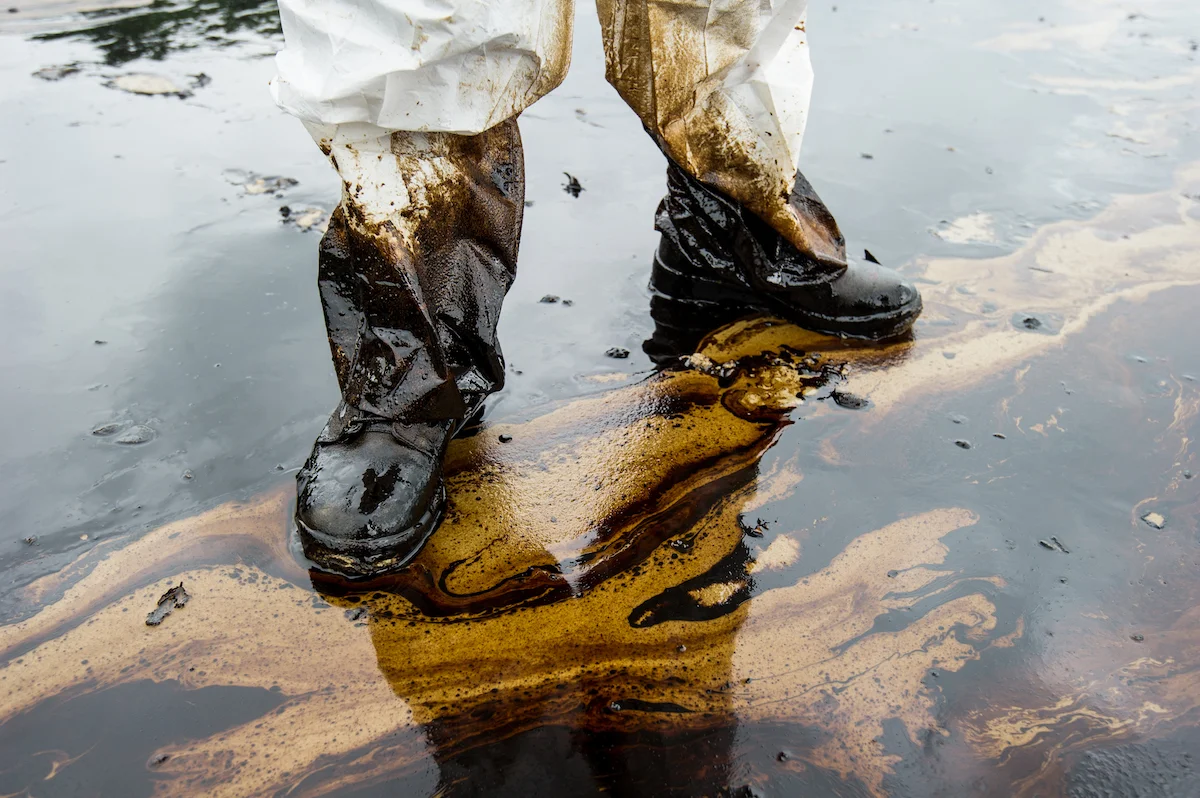
Description: Using a simulation game, students will explore trade strategies for a critical non-renewable resource, oil. Students will examine the differences between non-renewable and renewable resources. Students will examine the role Gross National Product plays in oil trade. Finally, students will recognize how crucial it is for countries to seek alternatives to be in place when non-renewable resource are depleted.

 Grade level(s): Middle                     Standards: PASS, GFL             Produced By: Tiffany Neill

The Anatomy of MIMAL

Click on the image above to download the lesson

Click on the image above to download the lesson

Description: The key topics the students will acquire at the end of this lesson are the path of the Mississippi River from its headwaters to the mouth, and the major tributaries that feed into the Mississippi River.

The facts that the students will acquire by the end of this lesson are the names of the states that border the Mississippi River and the exact location of all of the Mississippi River’s tributaries.

At the end of this lesson the students should be able to trace on a map the path of the Mississippi River, the path of all of its tributaries and label all the states that border the Mississippi River.

 Grade level(s): Middle                 Standards: PASS, GFL             Produced By: Helen Chaney-Hackney

Underground Wonders: Limestone and Gypsum Caverns

Click on the image above to download the lesson

Click on the image above to download the lesson

Description: Students will understand how different caverns are formed by comparing and contrasting the physical characteristics of limestone caverns and alabaster (gypsum) caverns.

 Grade level(s): Middle                 Standards: PASS, GFL             Produced By: Glenda Sullivan

Message in a Bottle: Latitude and Longitude

Click on the image above to download the lesson

Click on the image above to download the lesson

Description: Students will become more proficient in finding absolute locations by playing a board game which employs latitude and longitude coordinates to locate survivors of a shipwreck.

 Grade level(s): Middle                 Standards: PASS, GFL             Produced By: Glenda Sullivan

Easter Island

Click on the image above to download the lesson

Click on the image above to download the lesson

Description: The goal of this lesson is to engage students in learning about the geographic make-up of Easter Island and to have them draw conclusions about the fate of the inhabitants of Easter Island due to the limited resources to support human society and all its demands.

 Grade level(s): Middle                 Standards: PASS, GFL             Produced By: Teresa Potter

Running Out of Gas

Click on the image above to download the lesson

Click on the image above to download the lesson

Description: The goal of this lesson is to engage students in exploring gasoline consumption and energy conservation.  Students create oil product maps to compare Oklahoma to Syria, two oil producing places which are similar in size.  Students hypothesize about effective means of transportation to conserve energy.

 Grade level(s): Middle                 Standards: PASS, GFL             Produced By: Teresa Potter

All-Black Towns: Oklahoma's Unique Historical Geography

Click on the image above to download the lesson

Click on the image above to download the lesson

Description: Oklahoma has a unique history.  Most teachers and students do not realize that Oklahoma has more incorporated "historically all-black towns" than any other state in the United States.  In the early 1900s, town promoters selected parcels of land, plotted out townsites, and began building communities in Indian Territory for newcomers from Southern states to begin a new life.  In this lesson, the students will discover the unique and special features the town promoters used to attract the newcomers.  The students are to create promotional materials that would lure someone seeking a place of freedom from prejudice, a place to educate their children, a place to provide a home and provide for their family, a place to achieve economic success, and a place to live peacefully.  In addition, the students should gain an awareness of the human and environmental factors that made these places unique.

 Grade level(s): Middle                 Standards: PASS, GFL             Produced By: Shirley Nero

Oh! What a Clear View! Creating Cultures from Photos

Click on the image above to download the lesson

Click on the image above to download the lesson

Description: Many of us look at photographs in books, magazines, newspapers, but have never really asked ourselves, “What do these photographs reveal about the local culture?”  This lesson uses photographs from various sources to create an understanding of and determine cultural landscapes of any given area.  After a discussion of photos, the students will then use this information to create their own cultural landscape from one photo.  In a class presentation, the students will compare their cultures for similarities and differences.  The idea is to find out how many different cultural landscapes the students will produce from similar photos.

 Grade level(s): Middle                 Standards: PASS, GFL             Produced By: Shirley Nero

An Oily Mess

Click on the image above to download the lesson

Click on the image above to download the lesson

Description: The purpose of this lesson is to engage students in exploring the national problem of oil spills. Students will draw connections between oil use in their lives and how it connects to their lives.

 Grade level(s): Middle                 Standards: PASS, GFL             Produced By: Julie Guild

Immigration Push and Pull Factors

Click on the image above to download the lesson

Click on the image above to download the lesson

Description: The purpose of this lesson is to engage students in exploring the national issue of immigration.  Students will learn the facts of immigration and the problem of illegal immigration along the U.S. borders.

 Grade level(s): Middle                 Standards: PASS, GFL             Produced By: Julie Guild

Physical Elements of the Eastern United States

Click on the image above to download the lesson

Click on the image above to download the lesson

Description: In this lesson, students will study unique physical elements of the eastern United States, analyze how this could have had an impact on state boundaries, and develop “memory cues” for geographic (landform) vocabulary terms.

 Grade level(s): Middle                 Standards: PASS, GFL             Produced By: Janet Hall

Forced to Adapt

Click on the image above to download the lesson

Click on the image above to download the lesson

Description: In this lesson, students place themselves back in time and “predict” how removal to Indian Territory would impact the cultures of specific tribes from different geographical locations. 

 Grade level(s): Middle                 Standards: PASS, GFL             Produced By: Janet Hall

Geography Basics Institute 2006 Lessons Part Two

Click on the image above to download the lesson. This lesson will open in a Google Drive folder instead of a zipped file due to its size.

Click on the image above to download the lesson. This lesson will open in a Google Drive folder instead of a zipped file due to its size.

Description: The Geography Basics Institute lesson plans cover a variety of topics. This document contains the following lesson plans:

Part Two:

  • Exploring the Gulf Coast in the Aftermath of Hurricane Katrina - Page 1

  • Tsunami: Catching the Ultimate Wave - Page 17

  • What Are the Colors of Your State? - Page 29

  • Great Circles, Small Circles, and Distance - Page 37

  • What is Earth Science? What is Geography? - Page 47

  • Moisture: Using a Psychrometer - Page 57

  • Albedo - Page 63

  • Pressure & Wind - Page 69

  • As Far As the Eye Can See: Exercises in Remote Sensing - Page 77

  • 5 Themes of Geography - Page 93

  • Geographical Journey of Lewis and Clark - Page 101

  • Where In the World Am I? - Page 107

  • Population Thematic Maps - Page 110

  • Push-Pull Factors - Page 115

  • Latitude and Longitude Shape Africa - Page 125

  • South America Map It - Page 132

  • Mental Mapping Africa and Europe - Page 138

  • A Quarter’s Back Lesson - Page 144

  • In Between Geography - Page 147

  • Windows - Page 162

  • Windmills Around the World - Page 165

  • Interpreting the United States at Night - Page 171

  • Stand Up and Be Counted - Page 175

  • Mental Mapping - Page 181

  • Place and Poetry - Page 185

  • Tear the Continents - Page 189

  • 3D Geobooks - Page 192

  • Let’s Go Caribbean - Page 197

  • Jamestown Virginia - Page 201

  • Geography of Normandy - Page 209

  • Alphabetize Germany - Page 216

  • Country in a Box - Page 222

  • Cultural Symbols: Our Scenic World - Page 227

  • Worldwide Conflict and War - Page 231

  • Using Photographs to Teach Geography - Page 233

  • The World is a Colorful Place - Page 239

Grade level(s): Middle School
Standards: PASS, GFL
Produced By: Marco Micozzi and Glenda Sullivan.

Geography Basics Institute 2006 Lessons Part One

Click on the image above to download the lesson. This lesson will open in a Google Drive folder instead of a zipped file due to its size.

Click on the image above to download the lesson. This lesson will open in a Google Drive folder instead of a zipped file due to its size.

Description: The Geography Basics Institute lesson plans cover a variety of topics. This document contains the following lesson plans:

Part One:

  • What is Earth Science? - Page 1

  • Exercises in Remote Sensing - Page 13

  • Pressure & Wind - Page 29

  • Albedo - Page 37

  • Moisture - Page 43

  • Land & Water Contrasts - Page 55

  • Great Circles, Small Circles, and Distance - Page 67

  • Exploring the Gulf Coast in the Aftermath of Hurricane Katrina - Page 79

  • 5 Themes of Geography - Page 103

  • Where In The World Am I?- Page 111

  • Alphabetize Germany - Page 117

  • Country in a Box - Page 124

  • 3-D Geobooks - Page 129

  • Let’s go Caribbean - Page 134

  • Jamestown Virginia - Page 141

  • The World is a Colorful Place - Page 149

  • Using Photographs to Teach Geography - Page 152

  • Cultural Symbols, Our Creative World - Page 158

  • Worldwide Conflict and War - Page 163

  • Geography of Normandy - Page 165

  • Mental Mapping Africa and Europe - Page 172

  • South America Map It - Page 178

  • Latitude and Longitude Shape Africa - Page 183

  • Push-Pull Factors - Page 189

  • Population Thematic Maps - Page 199

  • Geographical Journey of Lewis and Clark - Page 205

  • Land & Water Contrasts - Page 255

  • Geology of the Wichita Mountains - Page 267

Grade level(s): Middle School
Standards: PASS, GFL
Produced By: Marco Micozzi, Glenda Sullivan, Dr. John Hogan, and Dr. M. Charles Gilbert