OAS

"Where Could I Bee" - North America - Updated 2025

Click on the image above to open the lesson. It will open as a Google Doc.

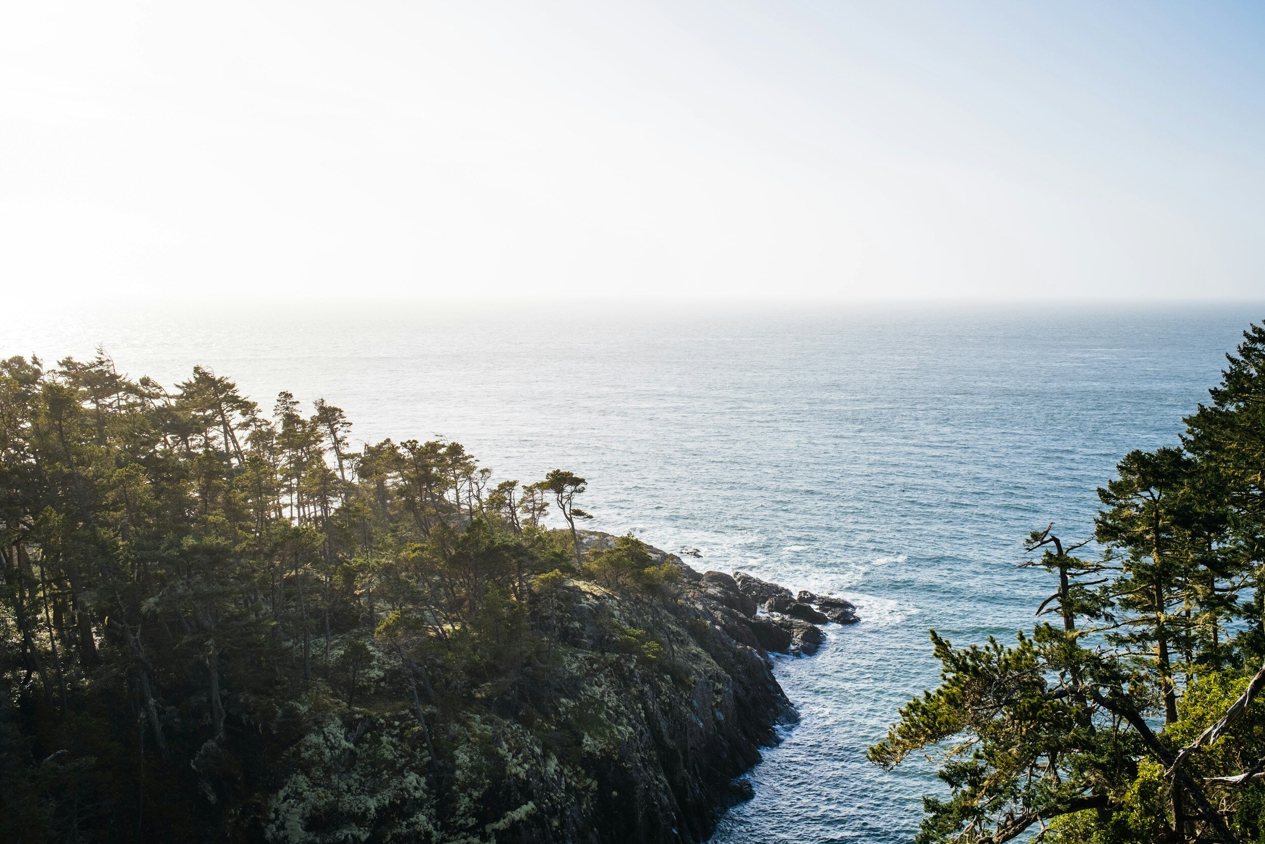
Description: This activity contains approximately 60 riddles about North America. These may be used as bell ringers, in conjunction with the Giant Map of North America, or to enrich other activities. Below please find a sample riddle from this packet.

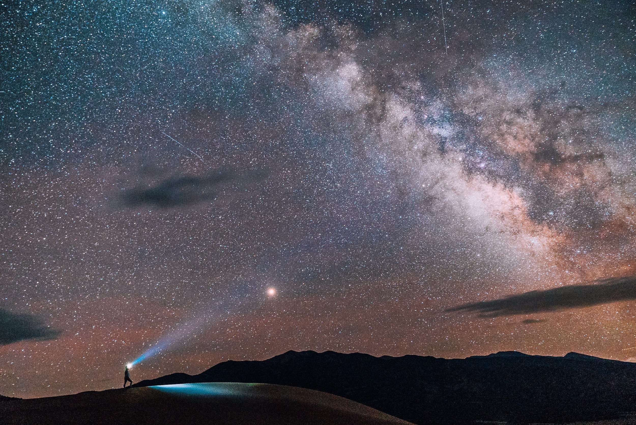
Tonight I’m out camping
Enjoying the dark
There are so many stars
Here in Yellowstone National Park
I think I see my home galaxy
Far away in the sky
Because locals here gave
Turning off lights a try
Under skies black and dark blue
I pose one question to you
Name each state this park occupies
Of which there are three
Then it will be no surprise
You’ve won Where could I bee

Download the packet and view Page 60 for the answer!

Grade level(s): Middle School, High School
Standards: OAS
Produced By: Richard Tuberville

"Where Could I Bee" - Asia - Updated 2025

Click on the image above to open the lesson. It will open as a Google Doc.

Description: This activity contains seven riddles about Asia. These may be used as bell ringers, in conjunction with the Giant Map of Asia, or to enrich other activities. Below please find a sample riddle from this packet.

I’m in a Cambodian temple
Around 900 years of age
Surrounded by jungle
It sets a beautiful stage
It was built in honor
Of a Hindu king
And the name of this temple
Is what you must bring
Without hesitation
And give it to me
If you want to win
Where could I bee

Download the packet and view Page 9 for the answer!

Grade level(s): Middle School, High School
Standards: OAS
Produced By: Richard Tuberville

"Where Could I Bee" - Middle East - Updated 2025

Click on the image above to open the lesson. It will open as a Google Doc.

Description: This activity contains eight riddles about countries in the Middle East. These may be used as bell ringers, in conjunction with the Giant Maps of Africa or Asia, or to enrich other activities. Below please find a sample riddle from this packet.

I’m climbing on mountains
As high as I can
But I’ve forgotten their name
Here in Southwest Iran
Tell me the name of this Middle Eastern mountain chain
Tell me where could I bee
With my forgetful brain

Download the packet and view Page 7 for the answer!

Grade level(s): Middle School, High School
Standards: OAS
Produced By: Richard Tuberville

Using the Pacific Ocean Giant Map to Understand Physical Features - Updated 2025

Click on the image above to open the lesson. It will open as a Google Doc.

Description: This is an interactive and engaging lesson designed to provide students with an understanding of the physical geography of the Pacific Ocean and the effects of various environmental phenomena. The lesson involves reading, researching, and interacting with the map to demonstrate understanding.

This lesson is designed to use the Giant Traveling Map of the Pacific Ocean to help students contextualize the physical features of the region.

This lesson is aligned with both National Geography Standards and Oklahoma Academic Standards, ensuring that it is not only educationally relevant but also beneficial for students. The activity provides a practical application of these standards, allowing students to see the relevance of what they are learning and how it applies to the real world. Please note this lesson may be adapted for use with digital or desktop-sized maps if the Pacific Ocean Giant Map is unavailable.

Grade level(s): Middle
Standards: OAS, GFL
Produced By: Grace Gierach

Using the Europe Giant Map to Plan a Backpacking Journey - Updated 2025

Click on the image above to open the lesson. It will open as a Google Doc.

Description: This is an interactive and engaging lesson designed to provide students with a comprehensive understanding of the European Union, the cultural touchstone of backpacking, and the geographical layout of European cities. The lesson involves reading, researching, and planning a backpacking journey through Europe. It is a hands-on activity that encourages students to apply their knowledge of geography, culture, and history to create a unique travel itinerary.

The rationale behind this lesson is to foster a deeper understanding of the interconnectedness of our world, particularly within the context of the European Union. By planning a backpacking journey, students will gain insights into the geographical, cultural, and historical diversity of Europe. They will also develop critical thinking and teamwork skills along with geographic awareness. This activity is designed to make learning geography an engaging and interactive experience, moving beyond rote memorization to application and analysis.

This lesson is aligned with both National Geography Standards and Oklahoma Academic Standards, ensuring that it is not only educationally relevant but also beneficial for students. The activity provides a practical application of these standards, allowing students to see the relevance of what they are learning and how it applies to the real world. Please note this lesson may be adapted for use with digital or desktop-sized maps if the Europe Giant Map is unavailable.

Grade level(s): Middle
Standards: OAS, GFL
Produced By: Cory Williams

Using the Africa Giant Map to Understand Latitude and Longitude - Updated 2025

Click on the image above to open the lesson. It will open as a Google Doc.

Description: In this lesson, students will investigate the significance of latitude and longitude in geography, such as understanding climate zones, temperature variations, time zones, and the ability to navigate and locate any place accurately. This activity may be completed with the Africa Giant Map, and can be adapted for digital or desktop-sized maps.

Grade level(s): Middle
Standards: OAS, GFL
Produced By: Cory Williams

Refugee Resettlement in Oklahoma - Updated 2025

Click on the image above to open the lesson. It will open as a Google Doc.

Description: Students will analyze and interpret geographic data, engage in critical thinking, and develop a deeper understanding of the social, economic, and environmental aspects of refugee resettlement in Oklahoma.

Grade level(s): Middle
Standards: OAS, GFL
Produced By: Cory Williams & Grace Gierach

Exploring Careers in Public Service - Updated 2025

Click on the image above to open the lesson. It will open as a Google Doc.

Description: Through this lesson and associated exercises, students will research specific public service careers to explore the role they play in their communities and governments, the benefits of working in public service, and how to pursue these careers.

Grade level(s): Upper Elementary, Middle, High
Standards: OAS, GFL
Produced By: Grace Gierach

Exploring Waste Management Careers - Updated 2025

Click on the image above to open the lesson. It will open as a Google Doc.

Description: In this lesson, students will learn about waste management and recycling and will research types of careers in this field. These include jobs in collection, distribution, manufacturing, research and development, maintenance, and sales. Students will examine real job postings online and reflect on the job duties along with the required skills, experience, and education.

Grade level(s): Middle
Standards: OAS, GFL
Produced By: Allison Taylor-Kniffen

Investigating Pollution and Establishing Environmental Stewardship - Updated 2025

Click on the image above to open the lesson. It will open as a Google Doc.

Description: Embedded within the Oklahoma Academic Standards for Social Studies is an opportunity to engage students in real-world problem solving. In this lesson, students will utilize this opportunity by applying the Geo-Inquiry process to investigate the impact of trash pollution on their campus or another selected site. In follow-up activities, students will explore the meaning of environmental stewardship through recycling practices and career exploration. Any part of this lesson can be adapted to best fit students’ needs and this activity includes cross-curricular opportunities which meet standards in English Language Arts, Mathematics, and Science.

Grade level(s): Middle, High
Standards: OAS, GFL
Produced By: Allison Taylor-Kniffen

Exploring Conservation Careers in Oklahoma - Updated 2025

Click on the image above to open the lesson. It will open in the Google drive.

Description: In this lesson, students will explore conservation careers, particularly those available in Oklahoma. Students will identify potential careers of interest, research the education and experience requirements, and will learn how to compose a resumé and cover letter.

Grade level(s): Middle, High
Standards: OAS, GFL
Produced By: Teresa Potter

What's on the Menu? Exploring Predator-Prey Relationships in Oklahoma - Updated 2025

Click on the image above to open the lesson. It will open in the Google drive.

Description: In this lesson, students will explore Oklahoma’s wildlife, their predator-prey relationships, and how they can be impacted by human activities.

Grade level(s): Middle
Standards: OAS, GFL
Produced By: Teresa Potter

Using Giant Floor Maps to Understand Bald Eagle Populations - Updated 2025

Click on the image above to open the lesson. It will open as a Google Doc.

Description: In this lesson, students will use the Oklahoma or North America Giant Floor Map to explore where bald eagles can be found, what the requirements are for a healthy habitat, and how their habitats are affected by human activity.

Grade level(s): Middle
Standards: OAS, GFL
Produced By: Becca Palczynsky

Leave No Trace - Updated 2025

Click on the image above to open the lesson. It will open as a Google Doc.

Description: This lesson is designed to introduce students to best practices for visiting city, state, and national parks. Students will learn how to enjoy and appreciate parks and other public lands while respecting other visitors, the land, and wildlife.

Grade level(s): Elementary, Middle
Standards: OAS, GFL
Produced By: Becca Palczynsky

Using the Oklahoma Floor Map to Explore Public Lands - Updated 2025

Click on the image above to open the lesson. It will open as a Google Doc.

Description: This lesson is designed to introduce students to different types of public lands in Oklahoma. These include National Recreation Areas, Wildlife Refuges, and State Parks. Students will learn where these parks are located, why they are established, and the activities they can do while there.

Grade level(s): Elementary
Standards: OAS, GFL
Produced By: Becca Palczynsky

Using the Asia Giant Map to Understand Light Pollution - Updated 2025

Click on the image above to open the lesson. It will open in the Google Drive.

Description: This lesson is designed to use the Giant Traveling Map of Asia to help students contextualize effects of light pollution in current events and upon migratory birds. These lesson materials are developed in support of OKAGE’s Geo-Inquiry project efforts.

Grade level(s): Elementary, Middle School, High School
Standards: OAS, GFL
Produced By: Grace Gierach

Half the Park is After Dark: Exploring Dark Sky Parks Around the World - Updated 2025

Click on the image above to open the lesson. It will open as a Google Doc.

Description: This lesson is designed as a template for a project focused on exploring dark sky parks in America and around the world. This lesson may be used to enrich instruction in a variety of subjects including Science, Mathematics, English Language Arts, and Social  Studies. The content presented in this lesson was selected as an illustrative example of how all subjects are used to understand a particular issue that impacts communities differently around the world and in Oklahoma.

Grade level(s): Elementary, Middle School, High School
Standards: OAS, GFL
Produced By: Tristan Lloyd

Designing and Siting a Pollinator Garden - Updated 2025

Click on the image above to open the lesson. It will open as a Google Doc.

Description: This lesson was created as a template to design and site a pollinator garden and provide examples of how a pollinator garden may be used to enrich instruction in a variety of subjects including Science, Mathematics, English Language Arts, and Social  Studies. The content presented in this lesson was selected as an illustrative example of  how all subjects are used to understand a particular issue which impacts communities  differently around the world and in Oklahoma. These lesson materials were developed  in support of OKAGE’s Geo-Inquiry project efforts.

Grade level(s): Elementary, Middle School, High School
Standards: OAS, GFL
Produced By: Tristan Lloyd

Using the Oklahoma Giant Map to Understand the Heavy Consequences of Light Pollution - Updated 2025

Click on the image above to open the lesson. It will open as a Google Doc.

Description: This lesson is designed as a template to introduce the Giant Traveling Map of Oklahoma and provide examples of how this map may be used to enrich instruction in a variety of subjects including Science, Mathematics, English Language Arts, and Social Studies. The content presented in this lesson was selected as an illustrative example of how all subjects are used to understand a particular issue which impacts communities differently around the world and in Oklahoma. These lesson materials were developed in support of OKAGE’s Geo-Inquiry project efforts. To sign up to participate in a dark sky Geo-Inquiry project with OKAGE, visit http://okageweb.org/event-registration-1 or contact us at okage@ou.edu.

Grade level(s): Elementary, Middle School, High School
Standards: OAS, GFL
Produced By: Becca Palczynsky

"Where Could I Bee" - Latin America - Updated 2025

Click on the image above to open the lesson. It will open as a Google Doc.

Description: This activity contains approximately 50 riddles about countries in Latin America. These may be used as bell ringers, in conjunction with the Giant Map of Latin America, or to enrich other activities. Below please find a sample riddle from this packet.

Where I am now
Is more “Chile” than cold
Although the degrees
Are about 30 below
In this place there is very little rainfall
And of Earth’s deserts,
It’s the driest of all
Tell me the name
Of this warm and dry land
And “Where Could I Bee?”
Will fall into your hand

Download the packet and view Page 23 for the answer!

Grade level(s): Middle School, High School
Standards: OAS
Produced By: Richard Tuberville